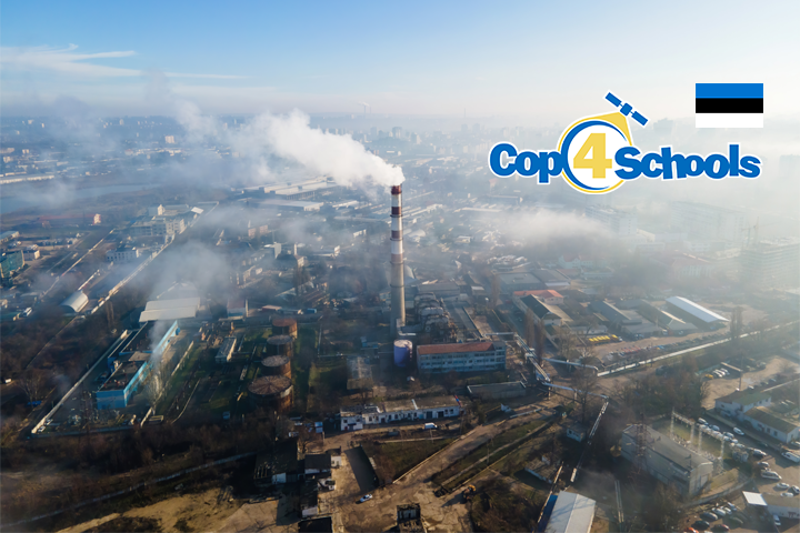
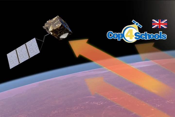
Categories
10 11 12 Copernicus Fach Geographie Klasse Klima Lerneinheit Material Uncategorized

Détection des émissions de méthane à
l’aide d’images satellites

Le méthane (CH4) est un puissant gaz à effet de serre et le deuxième plus grand moteur du réchauffement climatique. Les principales émissions proviennent de l’agriculture, des combustibles fossiles et des déchets. La concentration atmosphérique globale de méthane a augmenté depuis des décennies – d’environ 7 % depuis 2006. Le contrôle des émissions provenant de l’exploitation des combustibles fossiles présente le plus grand potentiel de réduction à court terme. Les fuites des pipelines et des champs de gaz sont imprévisibles et de courte durée. Il est possible de détecter ces fuites importantes à l’aide de satellites. L’Institut néerlandais de recherche spatiale a commencé à cartographier les grands panaches à l’aide d’images satellites et de l’IA. En janvier 2023, 192 de ces panaches ont été détectés, principalement en Asie.

Die App ist Teil der Columbus-Eye-App. Kostenlos erhältlich bei Google Play (Part “Sommer in Stadt, Land, Fluss”)

Die App ist Teil der Columbus-Eye-App. Kostenlos erhältlich im Apple Store (Part “Sommer in Stadt, Land, Flus”)

Objectifs: Les élèves…

  • sont capables d’utiliser des instruments de télédétection pour détecter les émissions de méthane (ou autres) ,

  • décrivent le niveau naturel de méthane ,

  • cherchent la raison pour laquelle les émissions de méthane peuvent être trop élevées.

Le fichier ZIP (2 Mo) contient les commentaires de l’enseignant et la fiche de travail.

Categories
10 11 12 Copernicus Fach Geographie Klasse Klima Lerneinheit Material Uncategorized

Satellite-based methane detection

Methane (CH4) is a strong greenhouse gas and the second biggest global warming driver. The primary emissions come from agriculture, fossil fuels and waste. Global atmospheric methane concentration has increased for decades – around 7% since 2006. Controlling fossil fuel operation emissions has the most significant short-term reduction potential. Leaks from pipelines and gas fields are unpredictable and short-lived. It is possible to detect these substantial plumes using satellites. Mapping large plums has been started by the Netherlands Institute for Space Research using satellite images and AI. In January 2023, they detected 192 of these plumes, mainly in Asia.

Die App ist Teil der Columbus-Eye-App. Kostenlos erhältlich bei Google Play (Part “Sommer in Stadt, Land, Fluss”)

Die App ist Teil der Columbus-Eye-App. Kostenlos erhältlich im Apple Store (Part “Sommer in Stadt, Land, Flus”)


Goals: The students…

  • are able to use remote sensing tools for detecting methane (or other) emissions,

  • describe the natural methane level,

  • search the reason why the emissions of methane can be too large.

The ZIP file (2 MB) contains a teacher’s commentary and the worksheet.

Categories
10 11 12 Biologie Copernicus Fach Geographie Klasse Klima Lerneinheit Material

Nachweis von Methanemissionen
anhand von Satellitenbildern

Methan (CH4) ist ein lebenswichtiges Treibhausgas und ein wesentlicher Faktor der globalen Erwärmung. So ist es von entscheidender Bedeutung, die Menge der Treibhausgase zu verringern. Dazu ist es wichtig, die Quellen der Treibhausgase zu ermitteln und zu überwachen. Deswegen zeigen wir den Schülerinnen und Schülern hier, wie man den Ausstoß von Methan nachweisen kann.

Ziel dieser Übung ist es, eine große Methanfahne anhand eines Beispiels in Algerien im Januar 2020 zu finden, eine mögliche Quelle der Fahne ausfindig zu machen und ihre Häufigkeit sowie den Anstieg der Methankonzentration im Vergleich zu den Hintergrundwerten zu untersuchen.

Die App ist Teil der Columbus-Eye-App. Kostenlos erhältlich bei Google Play (Part “Sommer in Stadt, Land, Fluss”)

Die App ist Teil der Columbus-Eye-App. Kostenlos erhältlich im Apple Store (Part “Sommer in Stadt, Land, Flus”)

Ziele: Die Schüler*innen …

  • sind in der Lage, Fernerkundungsinstrumente zum Aufspüren von Methan- (oder anderen) Emissionen zu nutzen,

  • beschreiben das natürliche Methanniveau,

  • suchen den Grund, warum die Methanemissionen zu hoch sein können.

Die ZIP-Datei (2  MB) enthält einen Lehrerkommentar und das Arbeitsblatt.

Categories
10 11 12 13 9 Fach Geographie Klasse Klima Material Physik

Was zeigen uns Satelliten-
Beobachtungen von
Methan?

Methan (CH4) ist nach Kohlenstoffdioxid (CO2) das wichtigste anthropogene Treibhausgas. Daher ist es wichtig, die atmosphärischen Konzentrationen dieser Gase streng zu überwachen. Wie aber kann man mittels Satelliten die atmosphärische Methan-Konzentration messen? Und Was zeigen uns diese Messungen?

Jahrgangstufen: 9,10,11,12,13

Bearbeitungszeit: 90 min

Fächer : Geographie, Chemie, Physik, Naturwissenschaften

Leitfrage: Was zeigen uns Satelliten-Beobachtungen von Methan?

Themen: Methan Konzentration, Klimaentwicklung, Klimawandel

https://www.iup.uni-bremen.de/carbon_ghg/Clim4Edu/interaktiv/anim/XCH4_OBS4MIPS_v4.4_5x5_100.gif
Categories
10 11 12 13 9 Copernicus Fach Lernvideos Material Physik

Specular and Diffuse
Reflection in
Radar Images

Light is reflected in a specific direction from smooth surfaces, while rough surfaces scatter it in many directions. Radar satellites use this principle for Earth observation. They send microwaves to the Earth and analyze the returning signals to identify different types of surfaces. Smooth surfaces appear differently on radar images compared to rough ones. By analyzing these differences, scientists can gather important information about the Earth’s surface. Stay tuned to learn more!

Specular and Diffuse Reflection in Radar Images
Categories
10 11 12 13 9 Copernicus Fach Geographie Lernvideos Material Physik

Space Thermometer

Measuring temperatures is something we do every day. But how do you measure the temperature of the entire Earth? This video introduces you to the Sentinel-3 satellite, our “thermometer in space.” You’ll learn how it measures the Earth’s heat from 800 km above, and what we can learn from it. We’ll look at fascinating thermal images, like one from a heatwave in Egypt. You’ll see how cities, deserts, and forests have different temperatures. In the end, we’ll explain why these measurements are so important for understanding climate change and extreme weather events.
Space Thermometer
Categories
10 11 12 13 9 Copernicus Fach Geographie Lernvideos Material Physik

Weltraumthermometer

Temperaturen messen, das machen wir jeden Tag. Aber wie misst man die Temperatur der ganzen Erde? Dieses Video zeigt euch den Satelliten Sentinel-3, unser “Thermometer im Weltraum”. Ihr erfahrt, wie er aus 800 km Höhe die Wärme der Erde misst und was wir daraus lernen können. Wir schauen uns spannende Wärmebilder an, zum Beispiel von einer Hitzewelle in Ägypten. Ihr seht, wie unterschiedlich warm Städte, Wüsten und Wälder sind. Am Ende erklären wir, warum diese Messungen so wichtig sind, um Klimawandel und extreme Wetterereignisse zu verstehen.

Weltraumthermometer
Categories
10 Copernicus Fach Klasse Lerneinheit Material Physik

Reflection in Focus-
Earth Observation by Radar Satellites

Reflection in Focus – Earth Observation by Radar Satellites

Radar satellites use the reflective properties of the Earth’s surface to gather valuable information. These satellites send electromagnetic waves to the Earth, which are reflected back from the surface and return to the satellite. The analysis of these returning signals makes it possible to identify different materials, structures, and even changes over time. But how do radar satellites use reflection to capture and analyze data about the Earth’s surface? And what can actually be detected in radar images?

  • Use the worksheet for this lesson to explore the phenomenon of reflection from the perspective of radar satellites with the help of the satellite image!
  • Watch the learning video and read the operating instructions carefully!

Learning Video:

How do radar satellites use reflection to analyze the Earth’s surface?

Operating Instructions:

1. Display  the interactive map:

Simply click on to switch to the interactive map and work with the satellite data. Mit einem Klick auf , you can return here!

2. Working on the Interactive Map:
  1. Click on the icon: in the interactive map to display details about the satellite data.
  2. This button displays an image of the dataset on the map (there is only one image in this dataset).
  3. You can also use it to hide and show the image again, which is indicated by this icon: 
  4. If you activate this button at the bottom of the image, you can read the reflection strength of the pixels. The higher the number (0-255), the stronger the reflection. A click on the image deactivates the mode.
 

The tools you can use to edit the image are accessed by clicking on “Tools”(1) auf. The help button (2) shows a short video explaining how to use the tool

 
3. What exactly does the tool do?

The tool marks pixels in the radar image that look similar, meaning they have similar reflection properties.

You activate the button   and then click on a pixel in the satellite image. The tool will now mark all other pixels in the satellite image that are similar, meaning they have similar reflection properties. You can adjust how similar they need to be using the “Adjust Tolerance” slider.  

  • 0 means: Zero tolerance! Only pixels that have exactly the same value (reflection) as the pixel selected in the image will be marked.
  • 100 means: Very tolerant! Pixels will be marked that fall within a value range of ±100 around the selected pixel.

After a short calculation time, the tool displays the area of the marked region in square meters in the satellite image.

Eotools – hello from the saved content!

Categories
10 11 12 13 9 Fach Lernvideos Material Mathematik Physik

Physik überlistet Physik:
Hochauflösende Radarbilder

Das Erzeugen scharfer Bilder aus dem All mit langwelligen elektromagnetischen Wellen stellt eine bedeutende technische Herausforderung dar. SAR, oder Synthetic Aperture Radar, ist eine Technologie, die es ermöglicht, die scheinbaren Grenzen der Physik zu überwinden. In diesem Video erfahrt ihr, wie SAR funktioniert und wie es physikalische Prinzipien nutzt, um physikalische Einschränkungen zu umgehen 

Physik überlistet Physik: Hochauflösende Radarbilder
Categories
10 11 12 13 9 Fach Lernvideos Material Mathematik Physik

Durchblicker –
Radarsatelliten im Einsatz

Satellitenbilder zeigen die Schönheit der Erde, ermöglichen neue Erkenntnisse in der Forschung und liefern wichtige Daten für zahlreiche Anwendungsbereiche. Doch was kann man auf ihnen wohl am häufigsten beobachten? Die Antwort: Wolken, Wolken und nochmals Wolken. Eine zeitlich lückenlose Beobachtung der Vorgänge auf der Erdoberfläche vom Weltall aus wird so natürlich erschwert. Doch es gibt Satelliten und Sensoren, für die Wolken kein Problem darstellen und die eine ganze Reihe von Eigenschaften haben, die sie zu wichtigen Werkzeugen für die Beobachtung unseres Planeten machen – die Radarsatelliten.

Durchblicker – Radarsatelliten im Einsatz